Archive for the ‘Innovations’ Category
Lights, Camera, Action!
Posted in blogging, Boating Gear, Innovations, iPad, iPhone App, Marine Industry, sailing, Technology, Travel & Leisure, tagged aqualuma, bluecube av, mariner amphibious drone, thru-hull leds on March 4, 2017|
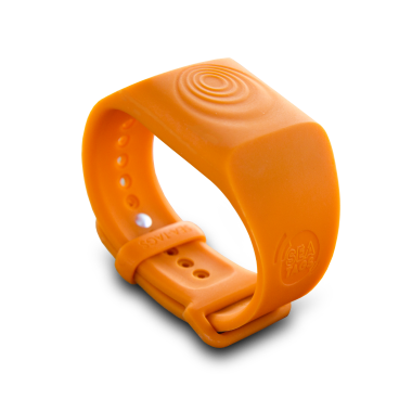
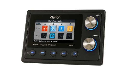
Review of Aqualuma Gen 4 Series Thru-hull LEDs, Aquatic AV BlueCube & Mariner Amphibious DRONE. Yachting Times Magazine, Spring 2015, page 66.
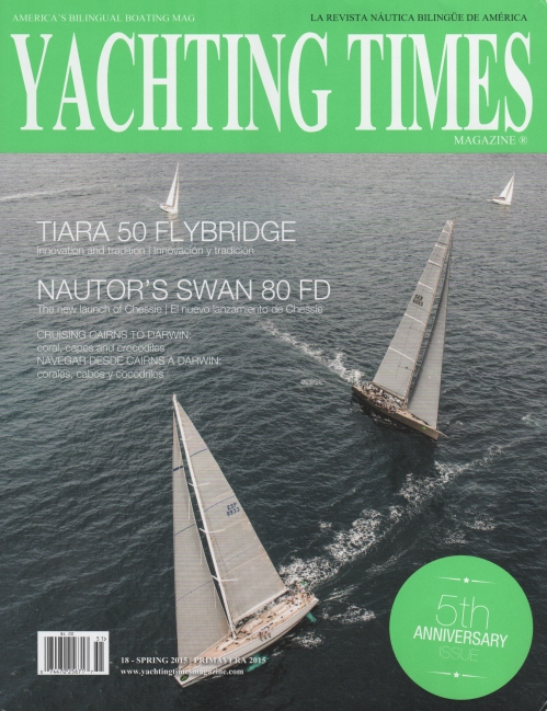
http://yachtingtimesmagazine.com/issue/18spring2015/pageflip.html
Latest Tech & Gear Column in Yachting Times Magazine – iBlinds
Posted in Boating Gear, Boating Resources, Gear, Innovations, iPhone App, sailing, Technology, Yachting on December 1, 2014|
The End of Paper Nautical Charts Coming in April 2014
Posted in boating, Boating Gear, Boating Resources, Cruising On A Cat, Cruising Resources, Innovations, iPad, iPhone App, publishing, sailing, social networking, Technology, Yachting, tagged charting, e-charts, Navigation, noaa, paper charts on October 23, 2013| Leave a Comment »

Out with the old?
In a press release issued yesterday, October 22, NOAA’s Office of Coast Survey, which creates and maintains the nation’s suite of thousands of nautical charts, announced that it will no longer print traditional lithographic (paper) nautical charts. The release went on to say that NOAA will continue to provide other forms of nautical charts, including print on demand (POD) and for electronic charting systems.
“Like most other mariners, I grew up on NOAA lithographic charts and have used them for years,” said Rear Admiral Gerd Glang, director of NOAA’s Office of Coast Survey. “We know that changing chart formats and availability will be a difficult change for some mariners who love their traditional paper charts, but we’re still going to provide other forms of our official charts.”

Plotting on paper
Since 1862, those lithographic nautical charts — available in marine shops and other stores — have been printed by the U.S. government and sold to the public by commercial vendors. The decision to stop production is based on several factors, including the declining demand for lithographic charts, the increasing use of digital and electronic charts, and federal budget realities.
“With the end of traditional paper charts, our primary concern continues to be making sure that boaters, fishing vessels, and commercial mariners have access to the most accurate, up-to-date nautical chart in a format that works well for them,” said Capt. Shep Smith, chief of Coast Survey’s Marine Chart Division. “Fortunately, advancements in computing and mobile technologies give us many more options than was possible years ago.”

Is it best to have both?
NOAA will continue to create and maintain other forms of nautical charts, including the increasingly popularPrint on Demand (POD) charts, updated paper charts available from NOAA-certified printers. NOAAelectronic navigational charts (NOAA ENC®) and raster navigational charts (NOAA RNC®), used in a variety of electronic charting systems, are also updated weekly and are available for free download from the Coast Survey website.
The world of navigation is benefiting from advances in technology, Smith explained. He said that NOAA will consult with chart users and private businesses about the future of U.S. navigation, especially exploring the use of NOAA charts as the basis for new products.
The Bottom Line

Electronic navigation is increasingly popular with recreational boaters.
It seems clear that NOAA isn’t making enough income off of paper. So they are moving towards more lucrative delivery systems.
This is good news for trailblazers like ActiveCaptain, the first to market with a crowd-sourced, electronic navigation product and the only Interactive Cruising Guidebook online. Since then, ActiveCaptain has been integrated with top e-nav systems across all platforms, like Garmin’s BlueChart Mobile, Navimatics Charts & Tides, Polarview, SEAiq, Jeppesen’s C-MAP, MaxSea, Nobeltec, and more.
Stop the Presses!
With all these choices available to everyone’s price-range, it’s no wonder NOAA has made the decision to stop the presses.
Paper charts will ultimately go the way of the Newspaper. As the developer of ActiveCaptain put it, ” I think that’s a big announcement and is just one more of a series of nails in the coffin of paper charts. It acknowledges what has happened in every other industry which has experienced similar technology changes. In this case, it’s the chart image, not the media, that’s important.”
It probably bodes well for cruising guide publishers like On The Water ChartGuides. Publisher Mark Doyle learned early on that if you’re going to compete in the digital navigation market, you’ll need to update often. His Intracoastal Waterway CruiseGuide and other guides come with free daily updates and alerts via Facebook, Twitter, RSS, and even text or email. As people find it too expensive to purchase charts Printed On Demand, they will want to turn to these comfortable chart books for detailed information and charts of US waterways.

PDF Chart of San Francisco Bay from NOAA.
FREE CHARTS! (For a Limited Time)
For a limited time, NOAA is offering its entire suite of charts in PDF file format. For the three-month trial period, you can download about a thousand high-resolution printable nautical charts – almost the entire suite of charts. These PDFs are exact images of the traditional charts we have come to love, currently printed by lithography. They are available now! Go to: http://www.nauticalcharts.noaa.gov/pdfcharts/ for info and to download the PDF charts. You’ll need to have their Chart Viewer to choose which numbers you want.
So whether you decide to give up your paper charts and go solely digital or hold out for another year, keep in mind that if you are using paper, you’ll have to check Local Notice to Mariners for updates – a time-consuming job, for sure!
Check out the discussion (it’s a lively one!) on ActiveCaptains eBoatCards Discussion Group. It’s free to join.
http://www.eboatcards.com/the2ndmostdangerousthing
Lastly, if you’re thinking about tossing your paper charts, consider giving them a second life by donating them to a local sailing group. Or send them to me and I will up cycle them into something very cool!
-Nancy
Boaters – What’s on Your Holiday Wish List?
Posted in blogging, Boating Gear, Boats for Sale, Innovations, Marine Industry, Newsworthy, Technology, Yachting, tagged boat toys, Holiday Shopping, luxury gifts, wish list on November 15, 2012| Leave a Comment »

The New Holiday issue of BayPop Magazine is available online now.
http://www.baypop.com/
Check out my column “Ship Chic” and discover the most luxurious yachts & yacht toys available for your wish list.
Enjoy!
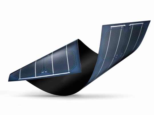
First Solar-powered Circumnavigation
Posted in adventure Sailing, boating, Catamarans, circumnavigation, Environment, Innovations, offshore sailing, Superyachts, tagged circumnavigation, energy, planetsolar, record, solar powered on May 10, 2012| Leave a Comment »
Stealth, Quiet, Grand & Easy on the Engines – Planet Solar Sets the Stage
Looking like something out of a science fiction or perhaps a James Bond film, the M/S Tûranor PlanetSolar, the world’s largest solar-powered boat, completed its around the world voyage to promote the use of sustainable solar energy this past Friday, May 4th.

Planet Solar arrives in Monaco. Images -www.planetsolar.org
A large crowd turned out to welcome the 115-foot catamaran, which holds the record as the largest solar-powered boat ever built. The leader of the

PlanetSolar expedition, Raphaël Domjan, told waiting reporters, “We are extremely happy to have achieved this first world tour with solar energy! We have shown that we have the technologies as well as the knowledge to become sustainable and safeguard our blue planet.”
Built in Germany at a reported cost of $24 million, the twin-screw catamaran — which is powered by electric motors and capable of cruising at approximately 8 knots — completed the 37,000-nautical mile circumnavigation using only solar energy, in 584 days. Some 5,780 square-feet of solar panels on deck charge what is said to be the largest lithium-ion battery in the world.
During the 19-month voyage, which began in Monaco Sept. 27, 2010, the 102-foot vessel crossed the Atlantic, passed through the Panama Canal and crossed the Pacific and Indian oceans.
The top investor in the project, German Immo Stroeher, said, “The M/S Tûranor PlanetSolar is much more than a ship. It has become an ambassador of solar energy.

 Planet Solar in Miami. Images- http://www.planetsolar.org
The name Turanor is derived from the “Lord of the Rings” series of books by J.R.R. Tolkien and translates into “The Power of the Sun.”
For more information on Planet Solar, visit them online!
You’re Invited! Thurs 4/14 – Lighthouse Pt. YC, Free Mobile Apps & Nav Software!
Posted in apps, boating, Boating Gear, clipper ships, Innovations, iPad, iPhone App, sailing, Technology, Yachting, tagged Android, App for Sailors, Best Apps, chartplotter, Hillsboro Inlet Sailing Club, iPad, iphone, Lighthouse Point Yacht Club, Navigation, Prizes, Raffle, software, Youth Sailing Program on April 13, 2011| Leave a Comment »
Please join me at the Lighthouse Pt. Yacht Club for the monthly Hillsboro Inlet Sailing Club‘s General Meeting and a special event!
After the General Meeting I will present a slide show of my recent Tall Ship cruises on the both the Royal Clipper & the Star Flyer. Our Special Event is a raffle of hundreds of Mobile Apps for boaters & sailors as well as Online Sail Training & Certification, Top-notch Navigation Software for PC/Mac, iPhone & iPad cases, GPS boosters for iPhone and more!
All Proceeds will go to benefit the Youth Sailing Program at HISC!
 About the Presentation:
Cruising is always an adventure, but Nancy has taken it to new heights – sailing and writing about cruising on tall ships, eco-adventure sailing and destination travel articles. Her love of sailing has now combined with her “inner geek,” to produce “iTapTouch, LLC” – the first mobile app development company dedicated to the Marine Industry.
The April general meeting is shaping up to be extra special as Nancy has put together an incredible collection of raffle prizes including codes to download free mobile apps, charting software programs, iPhone & iPad cases, Online Sail Training Courses, 12V USB power adapters and more! All proceeds from the raffle will go to the HISC Youth Sailing Program. A Big Thank YOU (!) to all the Developers and Vendors for their incredible generosity in donations.
When, Where…

6:30 (Cocktails & Mingling) or 7PM (Meeting and Presentation).
To be held at the Lighthouse Point Yacht Club:
2701 Northeast 42nd Street
Lighthouse Point, FL 33064-8476
(954) 942-3524
Directions:
Take I95 to Sample Rd Exit, head East to Federal Hwy (Hwy 1) and turn left or North to NE 39th Street. Go East to NE 27th Terrace (look for sign to YC) and turn left. Go to end and park.
A huge THANK YOU to our gracious Donors for giving so much!
Partial Donor List:
- Bad Elf: Assisted GPS Satellite data accessory/app for iPhone,iPad or iTouch (value $99.00ea)
- Boating Café: Boating Suite ($4.99)
- Derek Trauger & Assoc.:Dive Spots ($1.99), Bait Shops ($0.99)
- Gonzo Consortium: Bombora ($2.99)
- Cluebucket: WindBuoy ($3.99)
- Double Dog Studios: Boating Calcs ($2.99)
- Digital Forge: NavStation (.99), SailSim ($.99), VitalStatistics ($2.99)
- EarthNC: Marine Charts ($9.99)
- EZ Apps Inc.: EZ Radar – Florida Radar ($.99)
- Gigs, Inc: Signal Flags & Signal Flags International ($9.99)
- GPSNavX: iNavX ($49.99)
- Grog LLC: Animated Knots ($4.99)
- InfoBridge: WindAlert, 2- 6 month premium memberships ($60.00ea)
- Kitty Code: Hurricane HD for iPad and Hurricane for iPhone ($3.99), Traveler’s Quest Game ($.99)
- Michael Zapf Software: NMEAremote ($7.99)
- Memory Map: Pocket Nav ($19.99)
- Mobi Systems: Practical Encyclopedia of Boating (18.99)
- NauticEd Courses:
- 1st prize Captain bundle of courses (value $300)
- 2nd prize Bareboat Charter Master (value $160)
- 3rd prize skipper (value $95)
- Navimatics: Charts&Tides for East, Gulf & Great Lakes ($24.99)
- Navionics: – Chartplotter Apps, Charts and Laptop Software ($9.99-$130.00)
- Pinkfroot: ShipFinder ($4.99) & ShipFinder HD ($7.99)
- Roger Boesch: SailMaps ($5.99), SailBook ($5.99)
- TreeFrogPads: 5 Incredibly Sticky Pads! ($12.95 ea)
- LokSak: aLOKSAK waterproof bags and cases ($7.99 – 29.99)
- Otterbox: Universal iPhone 4 Defender Series case ($49.95)
- Polar Navy: PolarView NS – Navigation software licenses. ($39.99)
- Xantrex: 5 – USB DC Chargers ($9.99)
Not able to make it? No worries! Anyone who donates to the Youth Sailing Program can get free app codes or other prizes.
Email: info@itaptouch.com for details, but hurry because Apple Redeem Codes are only good for a short time!
Mobile Boat Ramp Application Receives Honorable Mention at NMMA Awards
Posted in apps, boating, Fishing, Innovations, iPad, iPhone App, sailing, small boats, Technology, tagged android apps, awards, boat gear, boat show, Boat Shows, boating, fishing, iphone, marine industry, miami boat show, MIBS, NMMA, sailing, small boats, Technology on February 21, 2011| 1 Comment »

The Boat Ramps Mobile App
The Recreational Boating & Fishing Foundation (RBFF) was honored today for innovative achievement by the National Marine Manufacturers Association (NMMA) and Boating Writers International (BWI) at the 70th annual Miami International Boat Show & Strictly Sail Miami. RBFF received an Honorable Mention in the 2011 Innovation Awards for its Take Me Fishing Boat Ramp App.
The National Marine Manufacturers Association (NMMA) and Boating Writers International (BWI) honored eleven marine products with 2011 Innovation Awards on Thursday and one as an Honorable Mention. The recognition took place during a State of the Industry Breakfast at the Miami International Boat Show & Strictly Sail Miami.
The Innovation Awards, organized by NMMA and judged by BWI, recognize products that best meet the following criteria: innovative distinction from other products currently being manufactured; benefit to the marine industry and/or consumer; practicality; cost-effectiveness; and availability to the consumer within 60 days of award receipt.
Among the winners for the Consumer Electronics and Software category, NMMA bestowed Honorable Mention to the Take Me Fishing Boat Ramp Mobile App. Available on iTunes and in the Droid Market, the FREE app allows users to search an impressive database of more than 35,000 launch points by city or zip code and even offers turn-by-turn directions. It’s already been downloaded by more than 27,000 mobile users.

BoatU.S. Mobile App
The app was developed by Derek Trauger & Associates who have a number of useful apps available for boating enthusiasts on both iPhone and Android phones. Traugers’ most recent: The BoatUS app that helps members call for a tow and includes helpful location and tracking features just for boaters, sailors and anglers. The moment you hit the App’s ‘Call Now for a Tow’ button, it automatically provides TowBoatU.S. with critical information before their crew even answers the phone.
Traugers’ other apps include Padi, Dive Spots, Bait Shops and iBoatShows. With over 60,000 downloads to date, Derek is on his way to becoming the top App Developer to the Marine Industry.
Yes, They Do Get It! NMMA Goes Mobile at MIBS
Posted in boating, boating blogs, Boats for Sale, Innovations, iPhone App, social media, Travel & Leisure, Uncategorized, Yachting, tagged boating, Boats, boats for sale, marine industry, miami boat show, MIBS, mobile apps, new campaign, NMMA, smartphones, Used Boats, Yachting, YACHTS on February 17, 2011| Leave a Comment »

Miami Beach Anchorage
MIAMI BEACH – The 70th annual Miami International Boat Show opened this morning riding a wave of renewed consumer confidence, with expectations that the industry will ride the big bow wake once again in 2011.
“We have been here before and we have come out of it,” Thom Dammrich, president of the NMMA. Adding, “We have momentum on our side.”
In this morning’s industry breakfast, NMMA’s VP of Marketing, Carl Blackwell introduced the newly redesigned Discover Boating campaign which focuses on the mobile tech market.
 NMMA has taken the lead once again and in an attempt to bring younger tech-savvy consumers to the sport, have just launched an app for the Miami Show for both Droid and iPhones. Also in the works is a new Facebook campaign to invite non-boaters to join in on the fun. The FB app will encourage those with boats to invite their friends to come out on the water and then hopefully “catch the bug!” Blackwell said he hopes the campaign will go viral.
Let’s give a big round of applause to the National Marine Manufacturers Assoc. for finally getting with the program and acknowledging the power of going mobile.
More than 2,000 exhibitors are at the Miami show this year, showcasing more than 2,500 boats, according to the NMMA. Along with Strictly Sail, the show runs through Monday.
-
Join 3,305 other subscribers
Share

-
Recent Posts
Gallery
-

This work is licensed under a Creative Commons Attribution-Noncommercial-No Derivative Works 3.0 Unported License. Sailing Top 40 iMix
- ac34 adventure sailing americas cup app awards blue water saling boat gear boating Boats boat show Boat Shows Bocas del Toro Caribbean catamaran charter charting circumnavigation clipper ships conservation cruisers Cruising On A Cat DYI Education emirates team environmental catastrophe finals fishing Florida good old boat Gulf of Aden hijacked boat iphone journalists King's Cup Regatta Louis vuitton marine industry missing cruisers Navigation NBC new zealand Nicaragua NMMA ocean health oceans offshore sailing oracle team usa Panama Pirate alley pirates racing Rolex Regatta S/V Quest safety sailboat Sailboats sailing sailing vacation San Francisco Bay save our seas sf bay small boats Somali pirates sports SSCA St.Thomas Star Flyer Technology Travel Used Boats weather women world cruising world series yacht Yachting
Archives
